Modesto sits on the eastern edge of the San Joaquin Valley, where the alluvial fans of the Tuolumne and Stanislaus rivers meet deep clay-loam soils. These deposits, often with low infiltration rates and high silt fractions, create conditions prone to surface erosion during winter rains. The region's Mediterranean climate concentrates 90% of annual precipitation between November and March, intensifying runoff on bare slopes and construction sites. A proper soil erosion analysis in Modesto must account for this seasonal pattern, the local soil erodibility factors, and the potential for ephemeral gully formation. Combining field reconnaissance with laboratory tests like the classification of soils helps engineers identify the most vulnerable layers before grading begins.
Without a site-specific erosion analysis, Modesto's winter storms can remove several inches of topsoil in a single season, undermining foundations and clogging drainage systems.
Methodology and scope
Our methodology follows the Revised Universal Soil Loss Equation (RUSLE2) framework, parameterized with local rainfall erosivity data from Stanislaus County. The analysis includes:
Rainfall-runoff erosivity (R-factor) calculated from NOAA Atlas 14 precipitation records for Modesto.
Soil erodibility (K-factor) derived from ASTM D2487 classification and ASTM D422 grain-size distribution.
Topographic (LS-factor) and cover-management (C-factor) assessment for the specific slope and vegetation conditions.
For deeper investigation, we incorporate infiltration tests to measure hydraulic conductivity at the site, which directly influences surface runoff generation and erosion potential.
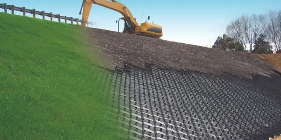
Technical reference image — Modesto
Local considerations
A residential development on the outskirts of Modesto, near the Tuolumne River corridor, faced a serious erosion issue during the 2023 storms. The contractor had stripped vegetation from a 4-hectare parcel to prepare for grading, leaving silty loam exposed. After two consecutive atmospheric river events, runoff carved gullies up to 1.5 meters deep, reaching the planned foundation footprints. The soil erosion analysis conducted afterward revealed that the site's K-factor of 0.44, combined with a C-factor of 0.45 (bare soil), produced estimated soil losses exceeding 50 tons per hectare per year. Mitigation required immediate reseeding and installation of sediment basins.
We survey the site to identify existing erosion features, measure slope gradients and lengths, and classify surface soil types. This includes GPS-based mapping of gullies and rills, along with infiltration tests to estimate runoff potential.
02
Laboratory Soil Erodibility Testing
Samples are tested in our ISO 17025-accredited lab for grain-size distribution (ASTM D422), plasticity index (ASTM D4318), and organic matter content. These parameters feed directly into the K-factor calculation used in RUSLE2.
03
Erosion Control Plan and Mitigation Design
Based on the analysis, we design site-specific erosion control measures: sediment basins, check dams, temporary seeding, and soil stabilization with geotextiles. Plans comply with the California Construction General Permit (CGP) requirements.
Applicable standards
ASTM D2487: Standard Practice for Classification of Soils for Engineering Purposes, ASTM D422: Standard Test Method for Particle-Size Analysis of Soils, RUSLE2 (Revised Universal Soil Loss Equation) – USDA-ARS, ASCE 7-22: Minimum Design Loads and Associated Criteria for Buildings and Other Structures (Chapter 10: Site Soils)
Frequently asked questions
How much does a soil erosion analysis cost in Modesto?
The cost for a standard soil erosion analysis in Modesto ranges from US$910 to US$2,310, depending on site acreage, number of samples, and complexity of the terrain. This includes fieldwork, lab testing, and a full report with RUSLE2 calculations.
What is the difference between RUSLE2 and the MUSLE model?
RUSLE2 estimates average annual soil loss from sheet and rill erosion based on rainfall erosivity, soil erodibility, topography, cover, and support practices. MUSLE incorporates runoff volume and peak discharge, making it more suitable for predicting sediment yield from individual storm events.
Do I need a soil erosion analysis for a small residential lot in Modesto?
Yes, if the lot is on a slope greater than 5% or has exposed soil during the rainy season. Modesto's building department often requires erosion control plans for land disturbance over 0.4 hectares. Even smaller lots benefit from analysis to prevent property damage and drainage issues.
How long does it take to complete a soil erosion analysis?
A typical analysis takes 2 to 3 weeks from initial site visit to final report. Fieldwork and sampling require 1 to 2 days, followed by lab testing (5–7 days), and then modeling and report writing (3–5 days). Tight deadlines can be accommodated with prior coordination.